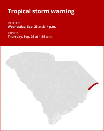
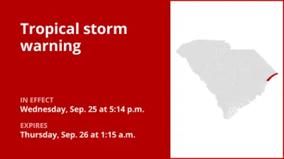
On Friday at 10:45 a.m. the National Weather Service issued an updated tropical storm warning in effect until 6:45 p.m. for Horry County.
The following information is provided by the weather service:
* LOCATIONS AFFECTED
– Surfside Beach
– Myrtle Beach
– North Myrtle Beach
* WIND
– LATEST LOCAL FORECAST: Below tropical storm force wind
– Peak Wind Forecast: 25-35 mph with gusts to 45 mph
– THREAT TO LIFE AND PROPERTY THAT INCLUDES TYPICAL FORECAST UNCERTAINTY IN TRACK, SIZE AND INTENSITY: Potential for wind 39 to 57 mph
– The wind threat has remained nearly steady from the previous assessment.
– PLAN: Plan for hazardous wind of equivalent tropical storm force.
– PREPARE: Efforts to protect property should now be underway. Prepare for limited wind damage.
– ACT: Act now to complete preparations before the wind becomes hazardous.
– POTENTIAL IMPACTS: Limited
– Damage to porches, awnings, carports, sheds, and unanchored mobile homes is possible. Unsecured lightweight objects may be blown about.
– Some large limbs may break from trees. A few shallow rooted or weak trees may snap or be knocked down. Some fences and roadway signs will be damaged.
– A few roads may become impassable due to debris, particularly within urban or heavily wooded places. Hazardous driving conditions are possible, especially for high profile vehicles on bridges and other elevated roadways.
– Scattered power and communications outages are possible.
* STORM SURGE
– No storm surge inundation forecast
– THREAT TO LIFE AND PROPERTY THAT INCLUDES TYPICAL FORECAST UNCERTAINTY IN TRACK, SIZE AND INTENSITY: Little to no storm surge flooding
– The storm surge threat has remained nearly steady from the previous assessment.
– PLAN: There is little to no threat of storm surge flooding. Rough surf, coastal erosion, and life-threatening rip currents are possible.
– PREPARE: Little to no preparations for storm surge flooding are needed.
– ACT: Follow the instructions of local officials. Monitor forecasts.
– POTENTIAL IMPACTS: Little to None
– Little to no potential impacts from storm surge flooding.
* FLOODING RAIN
– LATEST LOCAL FORECAST:
– Peak Rainfall Amounts: No additional significant rainfall forecast
– THREAT TO LIFE AND PROPERTY THAT INCLUDES TYPICAL FORECAST UNCERTAINTY IN TRACK, SIZE AND INTENSITY: Potential for localized flooding rain
– The flooding rain threat has remained nearly steady from the previous assessment.
– PLAN: Emergency plans should include the potential for localized flooding from heavy rain.
– PREPARE: Consider protective actions if you are in an area vulnerable to flooding.
– ACT: Heed any flood watches and warnings.
– POTENTIAL IMPACTS: Limited
– Localized flooding from rainfall may occur, especially in low-lying and poor drainage areas. Some rivers and creeks may rise as a result of the rain. Small streams, creeks, and ditches may overflow in some locations.
– Several storm drains and retention ponds may become full and begin to overflow. Some brief road closures are possible.
* TORNADO
– LATEST LOCAL FORECAST: Tornado Watch is in effect
– Situation is very favorable for tornadoes
– THREAT TO LIFE AND PROPERTY THAT INCLUDES TYPICAL FORECAST UNCERTAINTY IN TRACK, SIZE AND INTENSITY: Potential for many tornadoes
– The tornado threat has remained nearly steady from the previous assessment.
– PLAN: Emergency plans should include the potential for many tornadoes with some possibly intense having larger damage paths.
– PREPARE: Those living in manufactured homes or on boats should prepare to relocate to safe shelter before hazardous weather arrives.
– ACT: Listen for tornado watches and warnings. If a tornado warning is issued, be ready to shelter quickly.
– POTENTIAL IMPACTS: Extensive
– The occurrence of numerous tornadoes can greatly affect preparedness actions during tropical events.
– Tornadoes can significantly damage homes, destroy mobile homes, uproot and snap trees, destroy cars and boats. Large and deadly projectiles can add to the damage.
– Many places may experience tornado damage with a few spots of immense destruction, power loss, and communications failures.
This warning is in effect until 6:45 p.m.
